ADI KAILASH, AUM PARVAT, PANCHACHULI BASE CAMP EXPLORE
From
Duration
Trekking Type
Overview
Fees: ₹31,000 INR + Insurance
Group Size: 20 Participants
Age Limit: 15 Years and Above
About Adi Kailash Explore – Introduction
Adi Kailash, also known as Shiva Kailash, Chota Kailash, Baba Kailash, or Jyolingkong Peak, is a revered mountain situated in the Himalayan range in Pithoragarh district, Uttarakhand, India. It holds the second highest spiritual significance among the Panch Kailash—five sacred peaks—following Mount Kailash in Tibet. The others in this group include Shikhar Kailash (Shri Khand Mahadev), Kinnaur Kailash, and Mani Mahesh Kailash.
At the base of Adi Kailash lies Gauri Kund (Jyolingkong Lake) and Parvati Sarovar, two glacial lakes of great spiritual importance.
Located northwest of Gunji, both Adi Kailash and Limpiyadhura Pass are accessible through well-defined trekking routes. The main route (Route 1) to Adi Kailash is via Gunji, following the Pithoragarh–Lipulekh Highway and a motorable road through Kuthi Yankti Valley. Route permits are issued at Dharchula, where a mandatory medical check-up is conducted. Accommodation is available in villages along the route including Gunji, Napalchu, Nabi, Juli Kong, and Kuti.
An alternate route (Route 2) traverses through Darma Valley, crossing the Sin La Pass to reach Jyolingkong via Kuthi Yankti Valley. Many pilgrims use Route 2 for the onward journey and return via Route 1, joining the pilgrimage circuit of Aum Parvat and Kailash Mansarovar along the Sharda River.
Aum Parvat, situated in the same region, stands at 18,340 feet and is renowned for the natural formation of the sacred ‘ॐ’ symbol on its snow-covered peak. It symbolizes the four states of consciousness—waking, dreaming, deep sleep, and transcendental awareness—making it a profound spiritual site.
Program Highlights
During the Adi Kailash exploration, we will visit:
-
BhimTal
-
Pithoragarh
-
Dharchula (India–Nepal border)
-
Thakri Waterfall
-
Aum Parvat
-
Vyas Cave
-
Kali Mata Temple at Kalapani
-
Sheshnag Parvat
-
Adi Kailash Parvat
-
Parvati Sarovar
-
Parvati Mukut
-
Nabi Mahadev Temple
-
Ganesh Parvat
-
Pandav Parvat
-
Panchachuli Base Camp
Add-On (Subject to Permission): Visit Lipulekh Pass (17,500 ft) for an aerial view of Mount Kailash (Tibet).
Program Coordinator
Sourav: +91 9732596757
Booking Contact: WhatsApp on +91 9732596757 or Email at contact.the@yahoo.com
Adi Kailash Explore – Overview
| Parameter | Details |
|---|---|
| Best Season | May, June, September, October |
| Highest Altitude | Approx. 17,500 ft |
| Grade | Moderate |
| Activity Type | Exploration |
| Trail Type | 3-Point Exploration |
| Start/End Point | Kathgodam |
| Duration | 8 Days |
| Temperature | Max 18°C, Min -3°C |
| Total Explore Points | 7 |
| Category | Himalayan Views / Forest Trails / Meadows / Rocky Terrain |
| Base Camp | Dharchula |
| Higher Camp Stay | Forest Guest Houses, Hotels, Homestays, Tents, Shepherd Huts |
| Region | Pithoragarh District, Kumaon Himalayas, Uttarakhand, India |
| Famous For | Snow-covered peaks, pristine meadows, dense forests, ancient temples, and pilgrimage trails |
| Nearest Railhead | Kathgodam (271 km / approx. 10 hrs to Dharchula) |
| Nearest Airport | Pantnagar (305 km / approx. 11 hrs to Dharchula) |
| Mobile/Internet | Available up to Base Camp (Dharchula) |
| Electricity & Cloak Room | Available at Base Camp only |
How to Reach Kathgodam
By Road
Kathgodam is well-connected by road to cities in Uttarakhand, Uttar Pradesh, and Delhi. Buses operate from New Delhi (277 km), Lucknow (365 km), Dehradun (274 km), and Haridwar (225 km). Private vehicles also take scenic routes through hills and valleys.
By Rail
Kathgodam is the terminal station connected to Delhi, Lucknow, and Dehradun. Our transport team will be present outside the station to receive you.
By Air
Pantnagar Airport (35 km) is closest but has limited connectivity. Alternatively, Dehradun’s Jolly Grant Airport (257 km) offers better flight options. Taxis and buses are available from both.
Note: Kathgodam and Haldwani are twin towns.
Base Camp – Dharchula
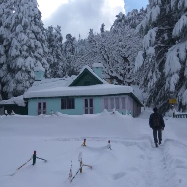
Dharchula, located at approximately 3,080 feet, is our base camp offering budget-friendly accommodation with essential amenities. The serene hill town serves as a perfect starting point for exploring Vyas Valley, Darma Valley, and Lipulekh Pass. The accommodation includes dormitory-style rooms, a communal dining space, and access to local attractions.
Food Details
We serve wholesome vegetarian meals with a mix of Indian and local flavors. Meals include:
-
Morning Tea
-
Breakfast + Tea
-
Hot/Packed Lunch
-
Evening Tea & Snacks
-
Soup
-
Dinner
-
Warm Drinks
Inclusions
-
Vegetarian meals from Day 1 (Evening Snacks) to Day 8 (Breakfast)
-
Accommodation on sharing basis (Dormitory, Hotel, Guest House, Homestay, Tent)
-
All required permissions
-
Local registered guides
-
Transportation (Day 2–7, Dharchula to Dharchula)
-
Group equipment if required
-
Exploration as per itinerary
-
Acclimatization training by a senior official
-
Medical kit with oxygen cylinder
-
Complimentary snacks, dry fruits, and cap
-
On-ground expert team assistance
-
Completion certificate from “The Himalayan Explorer”
Exclusions
-
Travel to/from Base Camp Dharchula
-
Meals during transit
-
Personal porters or mule charges
-
Emergency evacuation expenses
-
Personal trekking gear
-
GST, insurance, and other taxes
-
Personal expenses and tips
-
Activities beyond the listed itinerary
-
Lipulekh Pass permits
Conclusion
The Adi Kailash Explore program offers not just a visual treat of the majestic Himalayas but also a soulful spiritual experience. With panoramic views, sacred sites, and enriching cultural exposure, it’s a life-changing journey that remains etched in memory long after it ends.
Exploring Highlights
Peaks:
Adi Kailash, Aum Parvat, Namjungdung, Panchachuli, Mount Kailash (view)
Passes:
Lipulekh, Limpiyadhura, Unta Dhura, Kungribingri La, Sin La
Glaciers: (Please specify if known)
Rivers:
Ram Ganga, Padmavati, Gori Ganga, Dhauli Ganga, Kali (Sharda) River
Lakes:
BhimTal, Parvati Sarovar, Gauri Kund
Villages:
Dharchula, Tawa Ghat, Malpa, Bundi, Chiyalekh, Garbyang, Napalchu, Gunji, Nabi, Kuti, Dantu, Dugtu, Sone
Valleys:
Vyas Valley, Darma Valley, Kuthi Yankti Valley
Confluences:
Ram Ganga & Padmavati, Kali & Gori Ganga, Kali & Dhauli Ganga
Forests & Parks: (Add if applicable)
Extra Information
-
Wildlife: Himalayan black bears, leopards, bird species (Darma & Vyas Valleys)
-
Cuisine: Local Uttarakhand dishes
-
Adventure Options: Camping, bird watching, photography
-
Cultural & Spiritual Sites: Ancient temples and sacred peaks
-
Scenic Photography: Numerous vantage points for mountain and valley views
-
Weather: Cold, snowy at times—requires adequate gear
What to Bring
A full list of essential clothing and gear is included (items 1–32), covering trekking shoes, layered clothing, hygiene products, documentation, and emergency medicine.
Reporting Point
Kathgodam Railway Station, before 6:00 AM
Reporting Dates
📅 23rd May 2025, 1st June 2025
(Calendar format with click indicators can be added on the website or brochure)
Booking Instructions
To book, WhatsApp at +91 9732596757 or email contact.the@yahoo.com.
We will guide you through the registration and payment process.
Payment Details:
Account Name: The Himalayan Explorer
Bank: Punjab National Bank
Branch: Bongaon
Account Number: (Insert)
IFSC: (Insert)
QR Code: (Insert Image)
Booking will be confirmed only after receiving the payment and issuing the official “Program Joining Letter”. First-come, first-served basis.
Postal Address:
The Himalayan Explorer,
Above Aquarius Pet Shop,
Sharda Building, Shop No. 14,
Sanjauli Bazar,
Shimla, Himachal Pradesh – 171006
🗓️ DETAILED ITINERARY
🌄 DAY-WISE SCHEDULE
Day 1: Arrival & Drive to Base Camp (Dharchula)
-
Route: Kathgodam (1,483 ft) to Dharchula (3,080 ft)
-
Distance: 271 km | Time: ~10–12 hours
Participants must report to Kathgodam Railway Station before 6:00 AM. Our team will receive you and begin the scenic drive to Dharchula Base Camp. En route, enjoy the mesmerizing landscapes of the Kumaon region, including the iconic Bhimtal Lake, the vibrant Pithoragarh town, and scenic mountain vistas.
Upon arrival in Dharchula by evening, participants will check into their accommodation (Hotel/Homestay on a shared basis) and settle in for rest.
Key Landmarks: Bhimtal Lake, Ghat Sangam, Pithoragarh, Nepal-India View Point
Note: Meals during the car journey are self-arranged.
Connectivity: Trains and buses to Kathgodam are easily available from Delhi, Dehradun, Haridwar, and Lucknow.
Day 2: Acclimatization & Documentation Day
-
Location: Dharchula
-
Altitude: 3,080 ft
The day begins with light morning exercise followed by breakfast. The group will complete Inner Line Permit (ILP) formalities required for traveling near the Indo-Tibetan border.
Participants will then go on an acclimatization walk around Dharchula (India) and Darchula (Nepal) — two towns separated by the Kali River. Explore the Indo-Nepal bridge, Nepalese markets, and enjoy scenic photography spots.
After lunch, an orientation session will be conducted, covering safety instructions and trek protocols.
Overnight Stay: Dharchula Base Camp
Interesting Landmarks: Indo-Nepal Bridge, Darchula (Nepal), Nepal Market
Documents Required:
-
Programme Joining Letter
-
Adventure Sports Medical Certificate (for participants above 50 years, a new medical check-up will be conducted at a Govt. Hospital in Dharchula)
-
Government-issued ID & Address Proof (2 copies)
-
Application Form for ILP
-
Notarized Affidavit (₹10 stamp paper)
-
Two Passport-sized Photographs
-
Local Police Verification Certificate
Day 3: Drive to Gunji/Nabi Village (Vyas Valley)
-
Route: Dharchula to Gunji/Nabi
-
Distance: 92 km | Time: ~6 hours
-
Altitude: 10,500 ft
After breakfast, participants will drive toward Vyas Valley. The route is dotted with breathtaking natural beauty: snow-clad peaks, cascading waterfalls, and panoramic river views along the Kali River.
Key stops include Tawaghat (Dhauli Ganga & Kali River confluence), Malpa, Bundi, Chiyalekh, Garbhyang, and Napalachu. In Gunji/Nabi, participants will experience the warmth of traditional mountain hospitality in rustic yet comfortable homestays.
Explore the serene Kong Rong Village (20-minute walk from Gunji). Note that mobile network coverage ends post-Dharchula.
Overnight Stay: Gunji/Nabi Village Camp
Interesting Landmarks: Vyas Valley, Tawaghat, Malpa, Bundi, Chiyalekh, Garbhyang, Gunji, Nabi, Mount Namjungdung
Note: Road conditions may vary due to weather and landslides.
Day 4: Visit Mount Aum Parvat (Nabidhang)
-
Route: Gunji/Nabi – Nabidhang – Return
-
Distance: 50 km (round-trip) | Time: ~5 hours
-
Altitude: 14,100 ft (Nabidhang), 20,312 ft (Aum Parvat)
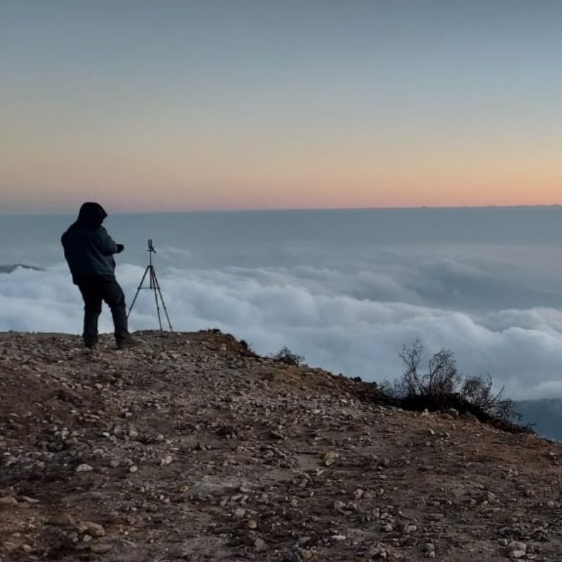
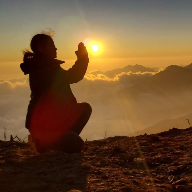
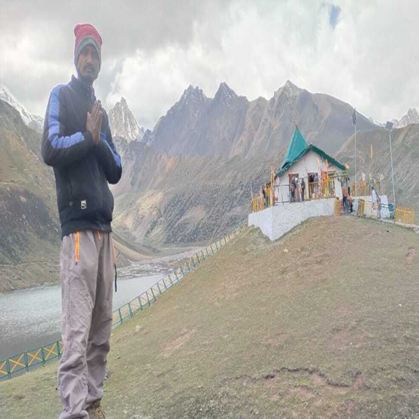
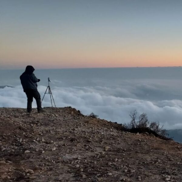
Begin the day early with a drive to Nabidhang. Key highlights en route include Kali Temple, Kali River Snout, Kalapani, and Vyas Gompha. The spiritual highlight is the stunning Mount Aum Parvat, where natural snow deposition forms the sacred “ॐ” symbol — a truly divine sight for pilgrims.
Enjoy a packed lunch amidst the snow-covered landscape and explore photography opportunities with majestic Himalayan backdrops. If permitted, we may also visit Lipulekh Pass for an aerial view of Mount Kailash (21,780 ft).
Overnight Stay: Gunji/Nabi Village Camp
Interesting Landmarks: Mount Aum Parvat, Kalapani, Kali River Snout, Vyas Gompha, Lipulekh Pass (if allowed)
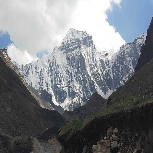
Day 5: Explore Mount Adi Kailash & Gauri Kund (Jyolingkong)
-
Route: Gunji/Nabi – Jyolingkong – Return
-
Distance: 86 km (round-trip) | Time: ~10 hours
-
Altitude: 15,000 ft (Jyolingkong), 19,500 ft (Adi Kailash)
Set off after breakfast for Jyolingkong. This is the most awaited part of the journey — the majestic Mount Adi Kailash. Visit Parvati Sarovar and the ancient Adi Kailash Temple (14,500 ft). From there, trek ~500m to Gauri Kund, a sacred lake nestled beneath Adi Kailash.
En route, stop at Kuti Village and the historic Pandav Fort (Pandav Kila). Visit Bhim ki Kheti, believed to be fields once tilled by Bhima from the Mahabharata.
Enjoy a hot lunch at Jyolingkong before driving back to Gunji/Nabi.
Overnight Stay: Gunji/Nabi Village Camp
Interesting Landmarks: Mount Adi Kailash, Gauri Kund, Parvati Sarovar, Kuti Village, Pandav Fort, Bhim Ki Kheti
Note: Be prepared for extremely cold temperatures and off-road conditions.
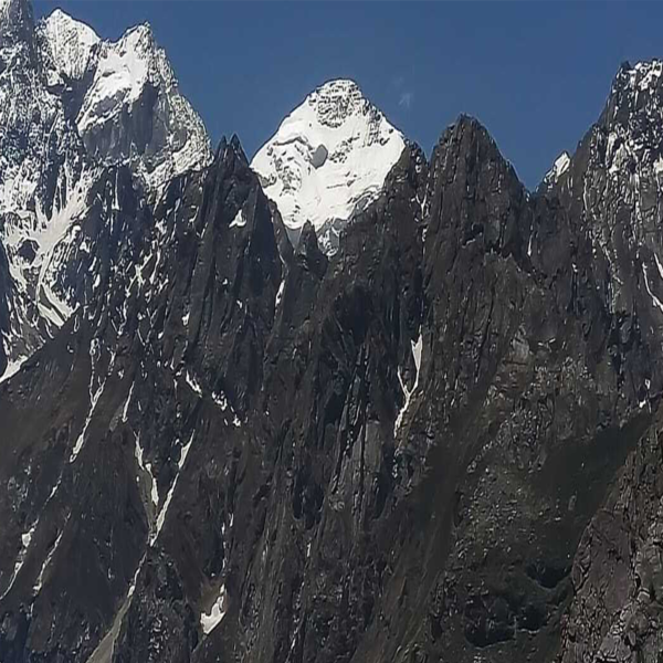
Day 6: Drive to Darma Valley (Dantu/Dugtu/Sone)
-
Route: Gunji/Nabi – Dantu/Dugtu/Sone
-
Distance: 56 km | Time: ~5 hours
-
Altitude: ~10,000 ft
The drive to Darma Valley is one of the most picturesque legs of the journey. The lush valleys, gushing streams, and vibrant alpine flora are a visual treat.
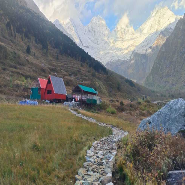
Marvel at the iconic Mount Panchachuli Peaks (20,781–22,651 ft), a set of five snow-capped summits that dominate the skyline.
Overnight Stay: Dantu/Dugtu/Sone Village Camp
Interesting Landmarks: Darma Valley, Dantu, Dugtu, Sone Villages, Panchachuli Peaks
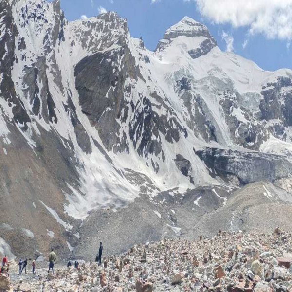
Day 7: Explore Panchachuli Base Camp & Return to Dharchula
-
Route: Trek to Panchachuli Zero Point, then drive to Dharchula
-
Distance: 7 km (trek) + 74 km (drive) | Time: ~3 hours (drive)
After an early breakfast, trek to Panchachuli Base Camp Zero Point (13,975 ft). This is the last viewpoint for the full range of Panchachuli Peaks. Take photographs, enjoy the view, and then return to camp for a hot lunch.
Later, drive back to Dharchula Base Camp. Enjoy a certificate distribution ceremony and a farewell dinner in the evening.
Overnight Stay: Dharchula Base Camp
Interesting Landmarks: Panchachuli Base Camp, Mount Panchachuli Peaks
Day 8: Departure – Dharchula to Kathgodam
-
Distance: 271 km | Time: ~10 hours
After breakfast, the group departs from Dharchula. We will drop you at Kathgodam Railway Station by evening. Participants may enjoy last-minute shopping or sightseeing before departure.
Note: Include a buffer day in case of unforeseen delays due to landslides, weather, or roadblocks.
Connectivity: Kathgodam is well-connected by train and bus to Delhi, Haridwar, Dehradun, and Lucknow.
Closing Note:
“Wish you a happy and safe journey from the entire team at THE HIMALAYAN EXPLORER.”
✅ THINGS TO REMEMBER
-
Keep a buffer day for delays.
-
Carry original and photocopies of ID documents.
-
Mobile network is unavailable in Vyas and Darma Valley — inform family in advance.
-
Inner Line Permit is mandatory (handled by us).
-
4×4 vehicles are highly recommended.
-
No public transport — travel is off-road and should be done with a trusted organization.
-
Weather can be extreme, pack accordingly.
📍 MAP & TREKKING GRADIENT
📜 RULES & REGULATIONS
Pre-Registration Requirements:
-
Read all program guidelines and cancellation policies.
-
Submit the following at reporting:
-
Medical Certificate (within 10 days of reporting)
-
Programme Joining Letter
-
Three Passport Photos
-
Two Photocopies of Govt. ID (carry originals too)
-
Important Notice:
Route and schedule are subject to change based on local conditions such as weather, landslides, or administrative restrictions.
Included/Exclude
Detailed Itinerary
Location
Find a route from your location
How To Book
For program booking please Whatsapp this number 9830500000. Or email us at booking@himalayanexplorer.com, and we will guide you in booking the program.
Related Adventure
Review Scores
How To Book
For program booking please WhatsApp this number 9732596757 Or email us at info@thehimalayanexplorer.com we will guide you in booking the program.
Booking Trek
Last Minute Deals